EcoDrone

Through loaner toolkits, immersive labs, and educational resources, EcoDrone democratizes access to drones and environmental technology, making science accessible to learners and educators regardless of their resources or experience. Learners of all ages can explore their local landscapes and collect data to inform meaningful civic action and natural resource management.
For educators · For youth spaces · For community groups · For place-based learning

EcoDrone identifier.

EcoDrone's Impact

25
loaner kits available across CT
102
kits gifted to K-12 teachers
145
formal and non-formal educators reached
5,378
clicks on associated materials
2,435
estimated learners of all ages reached through toolkit-supported learning experiences

Become an EcoDrone Explorer!

Explore the EcoDrone Pathway through immersive learning, forestry tools, and drone experiences. Whether you bring the learning to your own setting or we bring the lab to you, there are different ways to get started.

1. Use One of Our Loaner Kits

Get hands-on with specialized tools and investigate the world around you. Our Field Exploration loaner kits give communities, educators, and youth access to equipment for exploring local environmental conditions. Loaner kits are available exclusively to Connecticut-based programs, individuals, and organizations.
Forestry Kit: Explore tree measurements and forest inventory techniques. This kit includes a densiometer for estimating canopy cover, a clinometer for measuring tree height, a tangent height gauge for determining tree height and distance, a DBH tape for measuring tree diameter, and an angle gauge for estimating stand density and basal area.
Urban Forestry Kit: Investigate heat, sound, air quality, and local wildlife in urban areas. This kit includes a USB-C plug-in thermal camera compatible with Android devices, an infrared thermometer, binoculars for birdwatching, a sound level meter, and a handheld PM2.5 air quality meter.
Digital Forestry Kit: Measure light, wind, soil moisture, and other field conditions using digital tools. This kit includes an electrical conductivity meter for testing water samples, a soil moisture meter, a rangefinder to mesure tree height and distance, a light meter, and a portable wind station or anemometer.
Image shows a graphic featuring three boxes labeled Forestry, Urban Forestry, and Digital Forestry. Each box contains an open kit box surrounded by five tools. The Forestry kit includes a densiometer, a clinometer, a tangent height gauge, a DBH (diameter at breast height) tape, and an angle gauge. The Urban Forestry kit includes a thermal imaging camera, an air quality meter, a sound level meter, an infrared thermometer, and binoculars. The Digital Forestry kit includes a soil moisture meter, a light meter, a water electroconductivity meter, a rangefinder, and a handheld weather meter.

2. Or, We'll Bring the Lab to You!

Bring EcoDrone to your learning setting. Our traveling, hands-on lab experiences combine technology and interactive activities to make environmental exploration engaging. Traveling EcoDrone Exploration Labs are available exclusively to Connecticut-based programs and organizations. Experiences are offered to groups, not individuals.
Any of Our Kits: Learn about forestry, urban forestry, or digital forestry through hands-on demonstrations and guided investigations based on one of our three loaner kits.
Landscape-Themed Labs: Document landscape conditions through photography, compare and rank favorite images, landscapes, and stories, explore local biodiversity, and collaborate on thoughtful landscape designs that create supportive habitats for local wildlife.
Map-Themed Labs: Explore how aerial imagery, web-based mapping tools, and qualitative mapping activities support community-led environmental monitoring. Bring citizen science to life with our clip-on meters that capture real-time environmental data and automatically map your results.
Drone-Themed Labs: Explore the world of drones and their applications in forestry through flight simulators, interactive mission planning, obstacle courses, and kinesthetic games that bring drone flight concepts to life.
Inside a large outlined panel are four categories of portable learning experiences. The first category, "Any of Our Kits," displays tools from the three loaner kit options: Forestry, Urban Forestry, and Digital Forestry. The second category, "Landscapes," includes a camera, photo reaction stickers, a magnifying glass, and a community landscape drawing. The third category, "Maps," includes a printed map, and a smartphone connected to an environmental sensor. The fourth category, "Drones," includes a small drone, a virtual reality headset, and a drone flight simulator displayed on a tablet connected to a controller. Along the bottom are four blue storage bins labeled "Any of Our Kits," "Landscapes," "Maps," and "Drones." On the right side of the graphic is a vehicle, illustrating that these educational resources can be transported and brought directly to participants.

3. Access Our Bonus Resources

Use our bonus resources to support independent learning.
Activity Plans: Ready-to-use activity ideas for youth, community leaders, and educators, such as the Branch Out! or the Place-based STEM Learning through Drones collections.
Civic Action Handbooks: Explore practical, hands-on guides that explain the science behind the tools in our kits and show you how to put them to work. Start with the Urban and Community Forestry Handbook or explore the beta version of the Digital Environmentalist's Handbook. Each handbook complements its respective kit, helping you turn everyday observations into meaningful investigations and informed community action.
Field Apps: Join our crowdsourced data collection effort using the Urban Forestry Field App to observe, measure, and map environmental conditions using the urban forestry kit. The app was developed by Cary Chadwick of UConn CLEAR and piloted through UConn NRCA. We gratefully acknowledge Cary and the NRCA team for their support in making this resource possible.
Three outlined boxes appear. The first box is labeled "Activity Plans" and contains an icon of a light bulb representing educational activities and lesson plans. The second box is labeled "Toolkit Handbooks" and contains an icon of an open handbook with checklists and a gear, representing guidance materials and instructions for using the toolkits. The third box is labeled "Field Apps" and contains an icon of a smartphone, representing digital applications that can be used for data collection and field investigations.

A Collaborative Effort

Today, EcoDrone is a collaborative initiative involving the UConn Extension Forestry's Urban and Community Forestry Program, UConn Natural Resources Conservation Academy, UConn Department of Natural Resources and the Environment, UConn Center for Land Use Education and Research (CLEAR), the Landscape Ecology Lab at the University of Texas at El Paso (UTEP), and volunteer drone professionals. Together, we create educational experiences that integrate emerging technologies with environmental science, forestry, and natural resource management.


Meet the EcoDrone Team


The EcoDrone team combines expertise in forestry, environmental education, geospatial technologies, drones, and technology adoption to create engaging learning experiences that connect emerging technologies with natural resource management.
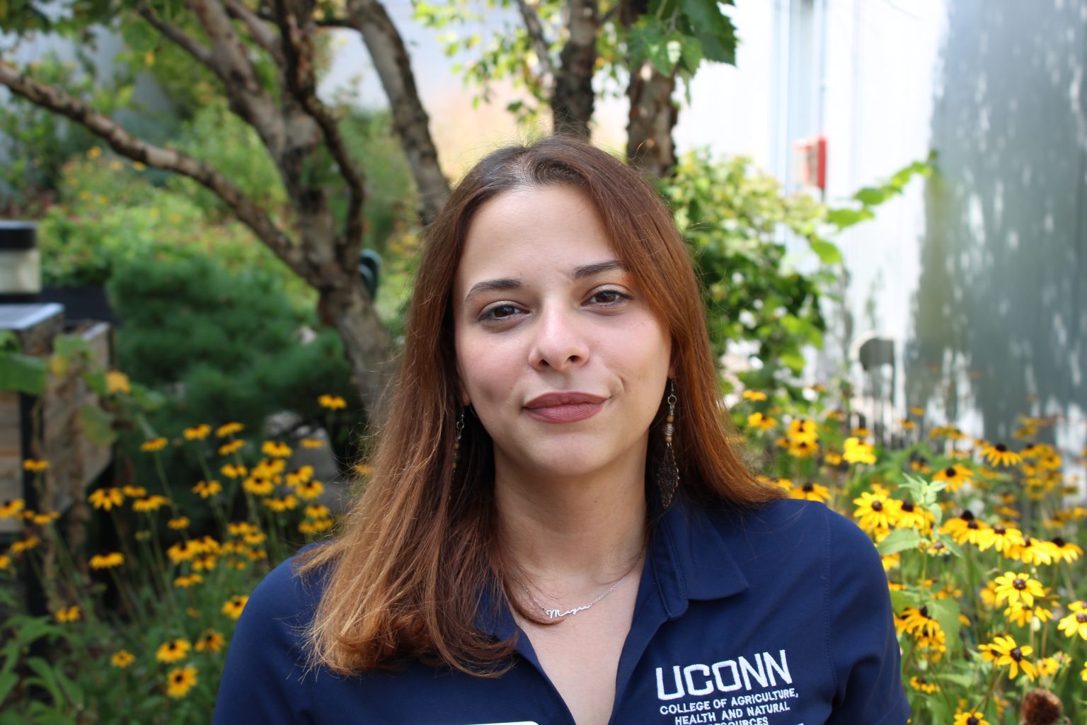
Dr. Mayra Rodriguez Gonzalez

Dr. Mayra I. Rodríguez González

Extension Urban Forester at UConn | Creator of EcoDrone

Mayra leads program development and manages EcoDrone's loaner kits, exploration labs, and educational resources, helping learners gain hands-on experience with environmental technologies.

Dr. Elizabeth La Rue

Dr. Elizabeth La Rue

Director of the Landscape Ecology Lab at UTEP

Liz and her graduate students contribute expertise in technology transfer, helping EcoDrone understand how emerging technologies and learning resources can be effectively adopted by different audiences.
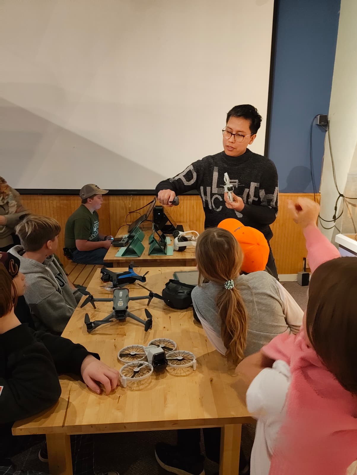
Kevin Torres Garrido

Kevin Torres Garrido

FAA Part 107 Pilot | Commercial Pilot | EcoDrone Volunteer

Kevin provides technical expertise, industry perspectives, and guidance on drone operations, safety practices, equipment selection, and professional standards.

Dr. Laura Cisneros

Dr. Laura Cisneros

Director of the UConn Natural Resources Conservation Academy

The NRCA serves as a testing ground for new EcoDrone kits and activities, allowing the team to pilot and refine resources with educators, youth, and communities before broader release.

Cary Chadwick

Cary Chadwick

Geospatial Education Expert at UConn CLEAR

Cary develops field data collection applications and geospatial tools that support hands-on environmental investigations, mapping activities, and community science projects.

Dr. Chandi Witharana

Dr. Chandi Witharana

Director of the Advanced Remote sensing Imaging and Analytics Lab at UConn

Chandi provides access to drone technologies, remote sensing expertise, and equipment that support EcoDrone's educational and research activities.


Publications and Research


You know us for our loaner kits, educational resources, and outreach programs. But did you know our team of researchers, educators, and Extension professionals also develops research-based frameworks and approaches to make technology transfer more effective? Explore our peer-reviewed journal articles, publications, and works in progress that advance the practice of community-engaged research, education, and technology transfer:


  • Rodríguez González, M. I., Dobbs, C., Verellen, T., Otero Mora, M. P., Doroski, D., Cisneros, L., Chadwick, C., & Ortega, I. (in preparation). Bridging science and community: A culturally-responsive toolkit for urban forestry education.
  • Rodríguez González, M. I., La Rue, E. A., & Torres Garrido, K. G. (in review). Co-designing digital forestry education through participatory needs assessment. Journal of Participatory Research Methods.
  • Rodríguez González, M. I., La Rue, E. A., & Torres Garrido, K. G. (in review). Lessons from a digital forestry youth pilot. Journal of Human Sciences & Extension.
  • Rodríguez González, M. I., Hernández Figueroa, J., & Oyola Remigio, D. (in revision). The ethical responsibility of youth development professionals in times of injustice. Journal of Youth Development.
  • Rodríguez González, M. I., Oyola Remigio, D., & Torres Garrido, K. G. (2026). Designing with, not for youth: Reframing participatory techniques as civic learning tools for urban greening and natural resources programming. Journal of Extension, 64(3), 7. https://commons.joe.org/joe/vol64/iss3/2/
  • Rodríguez González, M. I., & Torres Garrido, K. G. (2025). Culturally responsive STEM education: Integrating mapping techniques and drone technology for youth. Journal of Youth Development, 20(3), 9. https://open.clemson.edu/jyd/vol20/iss3/9

Contact Us

For information about EcoDrone, our loaner kits, or bringing an EcoDrone Exploration Lab to your learning setting, contact Dr. Mayra Rodríguez González (UConn Extension Urban Forester and Part 107 Remote Pilot) at mayra.rodriguez_gonzalez@uconn.edu.

UConn Extension logo

University of Texas at El Paso logo

Natural Resources Conservation Academy logo

UConn CLEAR logo

UConn Department of Natural Resources and the Environment logo